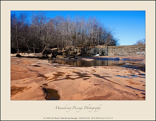
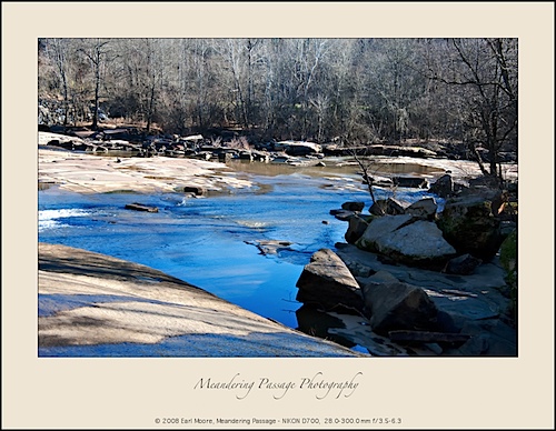
Low Water at the Bull Hole:
I travelled to the near-by dam/river area (Bull Hole) this morning only to find that the water level had dropped significantly.
I was there about a week ago and water was overflowing along the entire dam. This morning, water was only coming from a couple of bypass gates at the bottom of the dam. What a difference a week makes!
As a comparison you can view other photos from this same area, with higher water, here, here and here.
Google Maps to Find Photo Locations:
I read a post today from “The Daily Photography of Andreas Manessinger” where Andreas talked about relying on Google Maps for scouting photo locations.
Google Maps is also one of my main tools for finding new locations that hopefully will offer photo opportunities. My trip yesterday to “Boones Cave State Park” resulted from Google Maps research.
Once I find a likely location on Google Maps, I’ll do a Google Internet search for the local target area to see if there are any others who have photographed and posted photos of the area. This sometimes gives me an idea what I’ll find there and what camera lens/filter combinations might be of best use. The more I know of the area the better prepared I am to take advantage of my initial visit.
Discover more from Meandering Passage
Subscribe to get the latest posts sent to your email.


That’s interesting. I was just there on Friday and the water level was just fine. I got a number of nice photos. I wonder what happened.
Wow! I can’t believe that is the same place the we were just at a week ago. Its like two totally different worlds. I’m glad I got to see it on a busy day, but I bet it would be neat to really be able to walk out there.
@Paul: I knew you’d been there Friday, with water still flowing over the dam, so I was surprised it was so “dry.” This was as low of water level as when I first visited this summer. I don’t know if water normally recedes this quickly or not?
@Amberle: Big difference for sure! I’m glad you got to see it when there was good water flow.